
Walk the Muddy River: Boston’s Most Underrated Green Corridor, from the Fens to Jamaica Plain
If you want a Boston walk that feels local rather than checklist-driven, follow the Muddy River through the Emerald Necklace. This route links the Back Bay Fens, the Riverway and Jamaica Plain with bridges, shade, water views and a clearer sense of how Boston’s park system actually works.
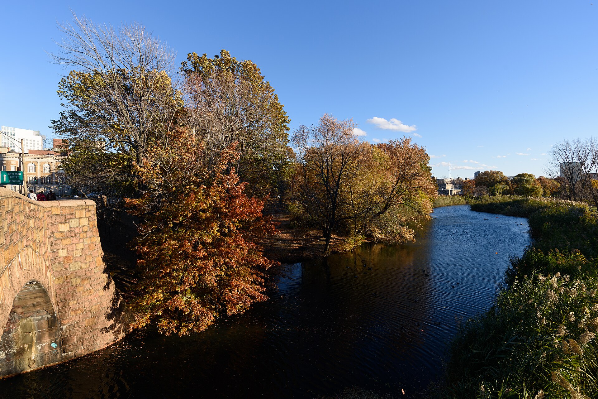
One of the best park walks in Boston is also one of the easiest to miss. The Muddy River corridor, running through the Emerald Necklace, gives you a more connected version of the city: less postcard, more actual Boston. Instead of circling a single lawn or heading for a harbor promenade, you can follow a chain of parkland shaped by water, bridges, marshy edges, old infrastructure and neighborhood seams.
This is not the same experience as a lap through Boston Common or a stroll in the Boston Public Garden. Those are essential civic landscapes. But if you want a longer, greener, more local-feeling outing, the Muddy River route is where Boston starts to unfold. It runs from the Back Bay Fens through the Riverway and onward toward Jamaica Plain, with the larger Emerald Necklace continuing to Jamaica Pond, the Arnold Arboretum of Harvard University and Franklin Park.
Why this corridor matters
The Muddy River is the central waterway of the Emerald Necklace, running from Jamaica Pond to its mouth at Charlesgate Park. The Emerald Necklace Conservancy describes the park system as roughly 1,100 acres extending from Back Bay through Brookline and Jamaica Plain to Franklin Park in Dorchester. That larger context is what makes this walk so useful: you are not just in a park, you are moving through Boston’s most important continuous landscape system.
The route also explains the city’s geography better than almost any museum label can. In the Fens, you see how a tidal, flood-prone landscape was transformed into parkland. Along the Riverway, the path narrows and bends with the river. Near Charlesgate, you can feel how roads and later infrastructure severed what had once been a direct connection to the Charles River.
Start in the Back Bay Fens
The easiest place to understand the walk is the Back Bay Fens in Fenway–Kenmore. This section mixes active park uses with quieter edges: athletic fields, memorials, community gardens, the James P. Kelleher Rose Garden and paths near the Muddy River. The City of Boston identifies the Fens as a major park landscape with those attractions, while the Emerald Necklace Conservancy notes that the Shattuck Visitor Center at 125 The Fenway occupies an 1882 former pump station built to control water flow.
That pump-station detail is more than trivia. It is the clue to reading the whole place. The Fens is beautiful, but it is also engineered. Water management, restoration and flood control are part of the park’s identity, not background footnotes.
If you begin here, keep your eyes open for the shifts in character within a short distance. One moment you are near formal garden spaces and ball fields; a few minutes later the river edge feels looser and more ecological. That variety is part of the appeal, especially if you want an outdoor route that feels richer than a straight recreational path.
Continue south on the Riverway
From the Fens, the route naturally carries you onto the Riverway, a 34-acre linear park along the Boston-Brookline line. The Emerald Necklace Conservancy describes it as a narrow park with paths following the meandering river, historic bridges and a former bridle path. This is the section that often surprises people who think of central Boston as hardscaped and crowded. The path becomes shadier, more enclosed and more textured by stonework and water.
It is a good walk in every season. In warmer months, tree cover matters. In cooler months, the structure of the landscape becomes more visible: bridge details, embankments, bends in the river, and the way the park was threaded into the city rather than set apart from it.
This stretch is also useful because it connects major cultural destinations without forcing you onto a purely urban route. The Emerald Necklace Conservancy specifically notes improved path connections between the Back Bay Fens and the Southwest Corridor near the Museum of Fine Arts, Boston, and the Fens remain within easy reach of institutions like the Isabella Stewart Gardner Museum. That means you can build a half-day around a park walk and one indoor stop without making the day feel overplanned.
What to notice as you walk
-
The river itself: The Muddy River is not a grand waterfront. That is exactly why it is interesting. Its scale makes the landscape feel intimate and distinctly Boston.
-
Historic bridges and crossings: The Riverway is known for bridges and layered circulation, including traces of former carriage-era design.
-
Evidence of restoration: The Muddy River corridor has been the focus of major flood-risk and environmental restoration work for years. The public-facing result is not a spectacle but a healthier, more resilient park landscape.
-
Shifts between neighborhoods: The walk helps you feel the edges of Fenway–Kenmore, Back Bay and Jamaica Plain in a way driving never will.
How far should you go?
The best version of this outing is flexible. If you want a shorter walk, stay around the Back Bay Fens and the first part of the Riverway. If you want a more immersive one, keep following the Emerald Necklace southward. The Conservancy identifies the broader chain as linking Charlesgate Park, the Back Bay Fens, the Riverway, Olmsted Park, Jamaica Pond, the Arnold Arboretum of Harvard University and Franklin Park.
For many visitors, the sweet spot is to treat the Fens and Riverway as the core route, then continue only if the day and your energy allow. That keeps the walk approachable while still giving you the sense of moving through a true park system rather than a single destination.
A note on access and terrain
One reason this corridor works for repeat use is that different segments offer different levels of intensity. Some sections are broad and straightforward; others are more winding and uneven. If you extend your outing all the way to the Arnold Arboretum of Harvard University, note that the Arboretum is free and open daily from dawn until dusk, and it publishes accessibility information including accessible parking areas, restrooms and a weekday driving permit by reservation for visitors with accessibility needs. Not every interior path there is accessible: Hemlock Hill, for example, is specifically identified by the Arboretum as rugged, potentially muddy and not wheelchair accessible.
That distinction is helpful beyond the Arboretum. In Boston park coverage, “green” can sound interchangeable. On the ground, it is not. The Muddy River corridor is valuable precisely because it gives you options, from easier paved or stone-dust stretches to more natural-feeling extensions.
Why this is a better local recommendation than a generic “best parks” list
Boston has plenty of famous open spaces, and they deserve their reputations. But a useful local recommendation should do more than name them. The Muddy River walk gives you a practical route, a piece of Boston history, and a framework for understanding how Fenway–Kenmore and Jamaica Plain connect through landscape rather than just streets.
It is also a reminder that some of Boston’s best outdoor experiences are linear, not iconic. You are not chasing a single viewpoint or landmark photo. You are following one of the city’s defining ecological and design systems, section by section, and noticing how the parkland still works.
If you only know the city through major stops like Boston Common or the Boston Public Garden, make this your next walk. It is greener, quieter, more layered and, in the best way, more Boston.